
Mt. Gambia is at the heart of the Limestone Coast in the south-east of South Australia, just 11 kms from the Victorian border, so it was a quick trip from Portland.
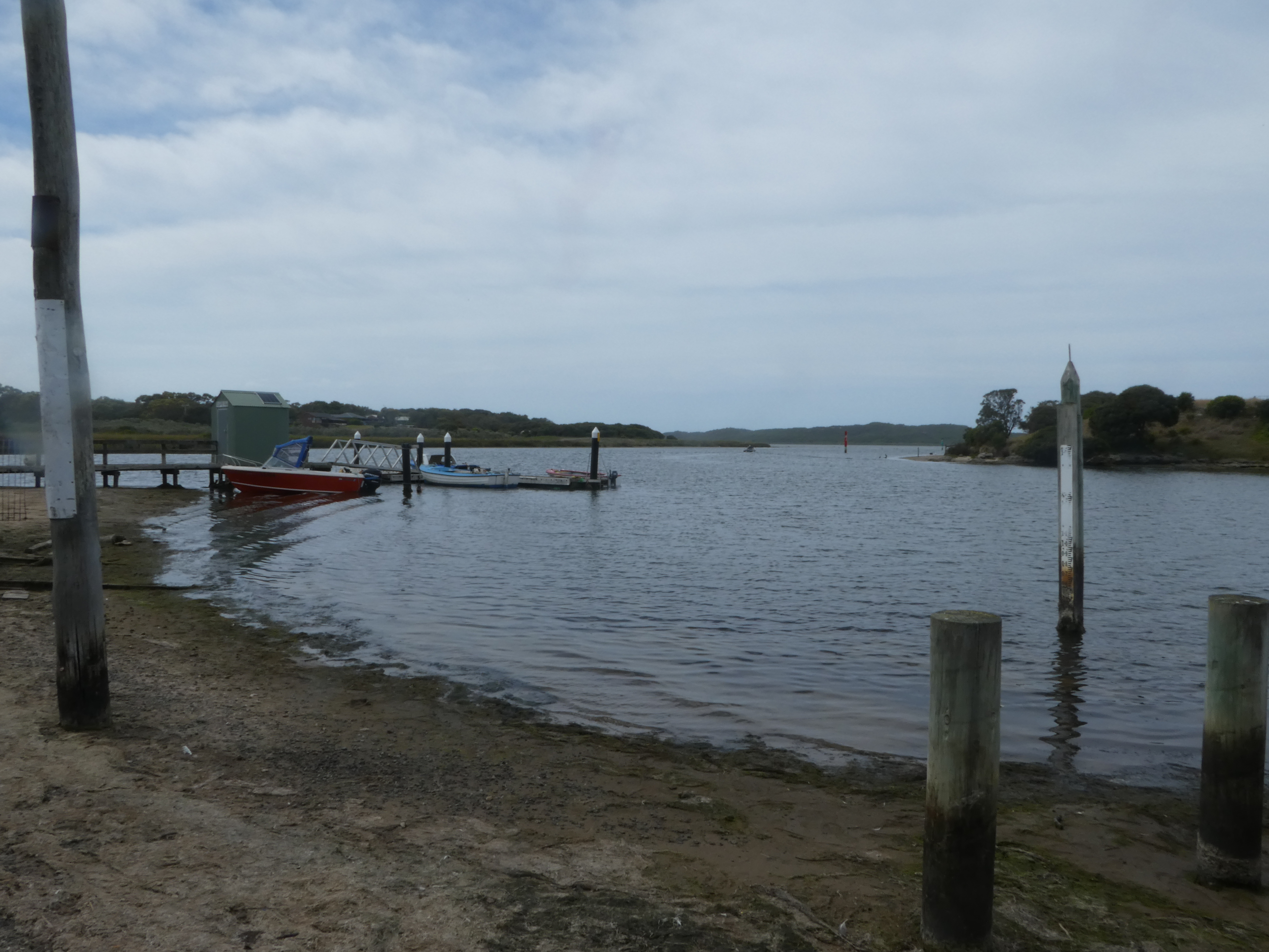
I cut away from the highway down to the coast for a short stop at Nelson, a pretty spot where the Glenelg River enters the sea.

Mt. Gambia’s colonial history goes back to 1800, with the sighting of the dormant Mount Gambier crater by Lieutenant James Grant, from the survey brig, HMS Lady Nelson. Named after Lord James Gambier, Admiral of the Fleet, it was the first place named by the British in what was later to become the colony of South Australia.
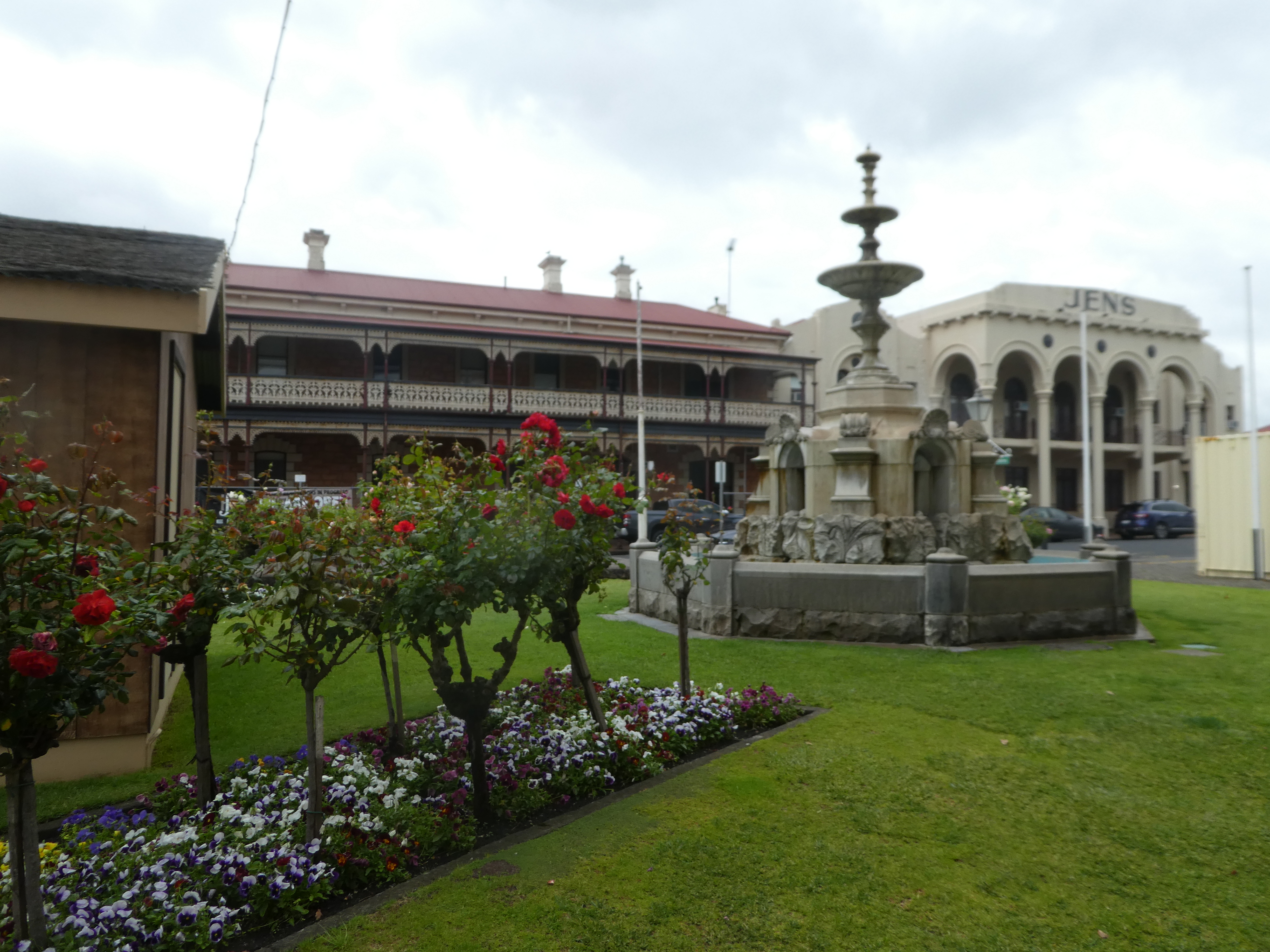
It’s a nice place, full of colonial-style buildings in the local creamy white limestone and pinkish dolomite. I particularly loved the very impressive Old Town Hall.


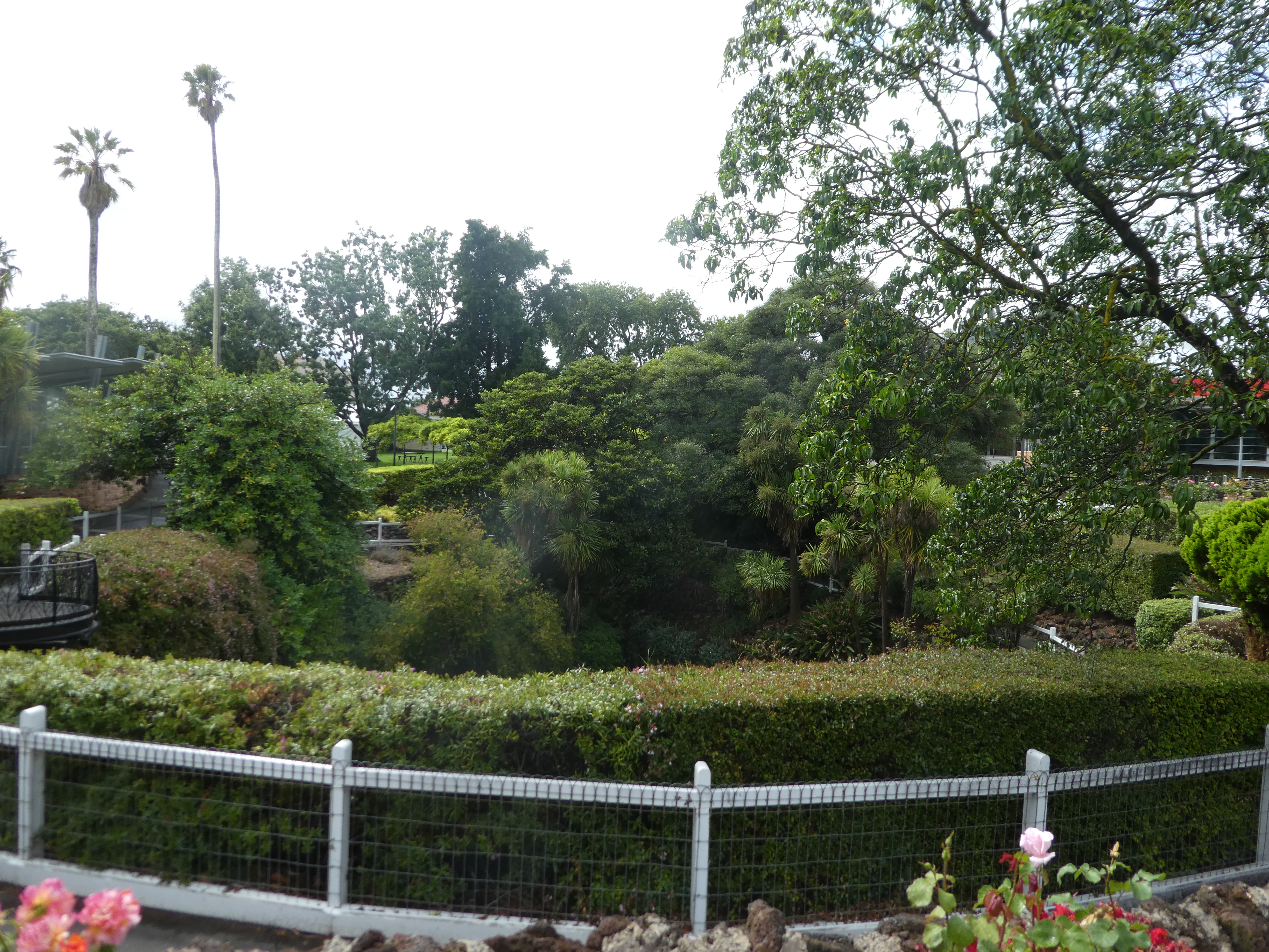
There are very pretty gardens in the centre of town with their own sinkhole.

Hidden beneath the Limestone Coast is a Swiss cheese network of 800 caves, from lava that erupted from volcanoes thousands of years ago. Over time, some of the roofs of these caves collapsed, exposing the existence of 50 sinkholes in the region.
As I said in my last post, it was a flying visit as I needed to get back home by a certain date. Hence, I didn’t have much time for exploring, so I concentrated on the major tourist attractions: the Blue Lake and Umpherston Sinkhole.
The Blue Lake is an extinct volcano. Its water changes colour through various shades of blue, depending on the season. I was lucky to be there in summer to see it in stunning cobalt.

The Blue Lake has a 3.5 kilometre walking track around its circumference, which you can also drive.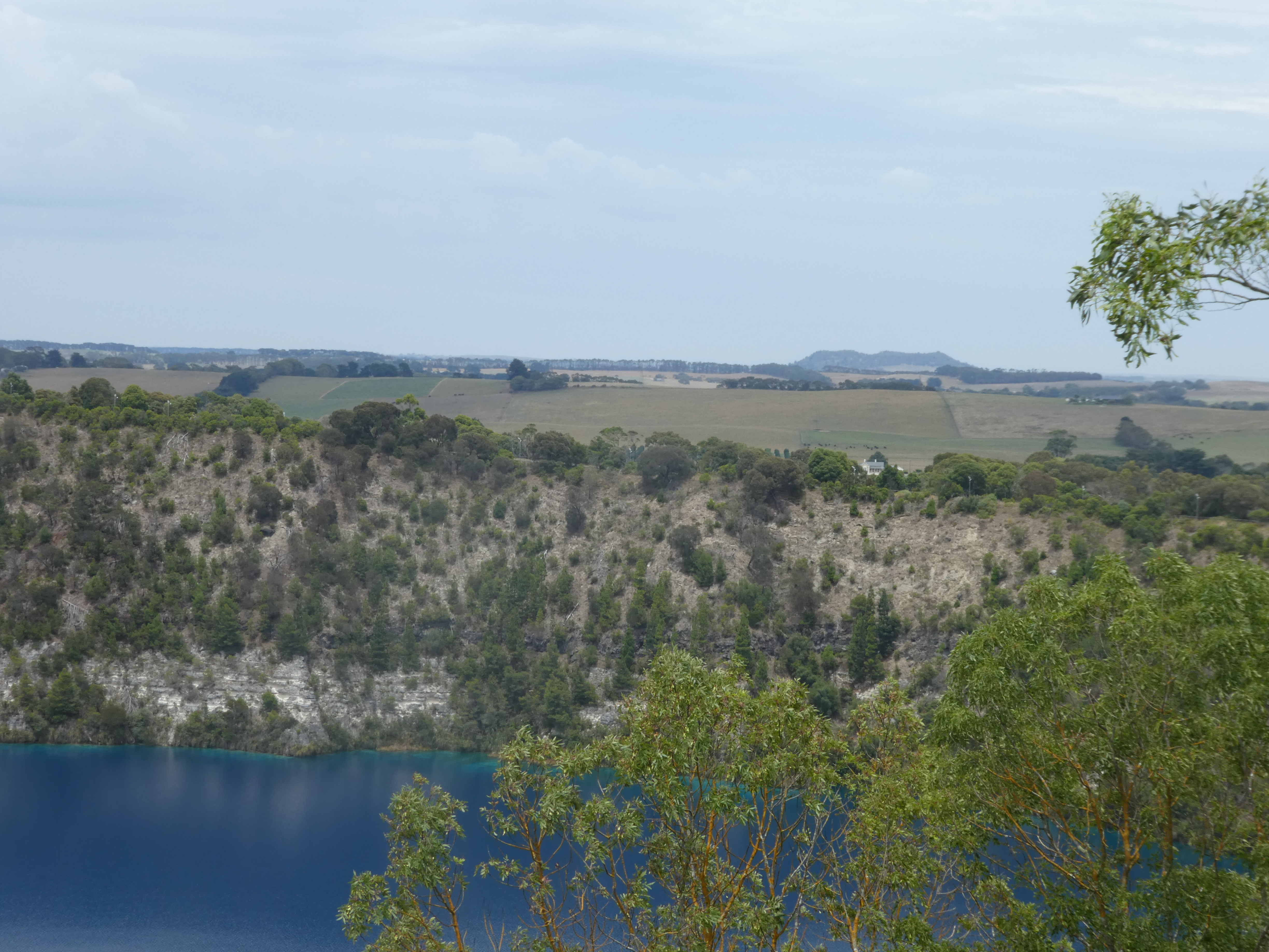
After a trip back into town for something cool to drink (it was awfully hot that weekend), I headed the 3 kilometres out of town to Umpherston Sinkhole.
In 1860, James Umpherston purchased 178 acres of land which included the sinkhole. He made extensive improvements to the property, including a grand Victorian residence and gardens.
In 1886, he started developing the sinkhole as a garden for his guests, to escape the summer heat. A footpath and stair case were erected to take visitors down through terraces and rock walks to ferns, shrubs and trees at the bottom.
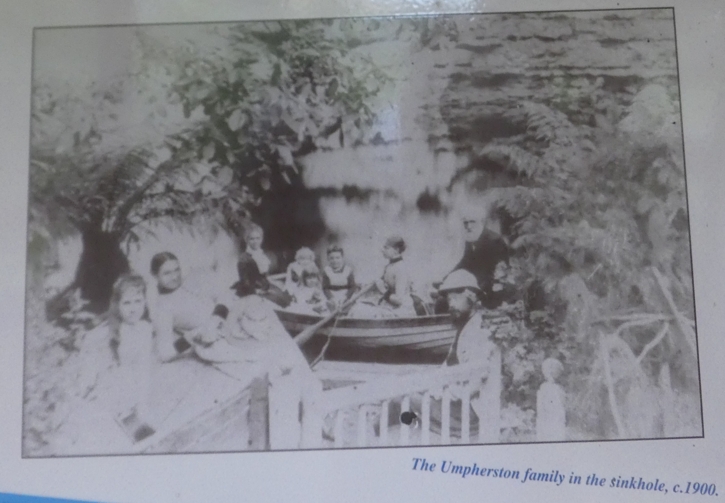
A third of the floor of the sinkhole was covered in water, and so guests were supplied with a boat to punt themselves around. He even built an island in the middle of it to add to the fairyland scene.
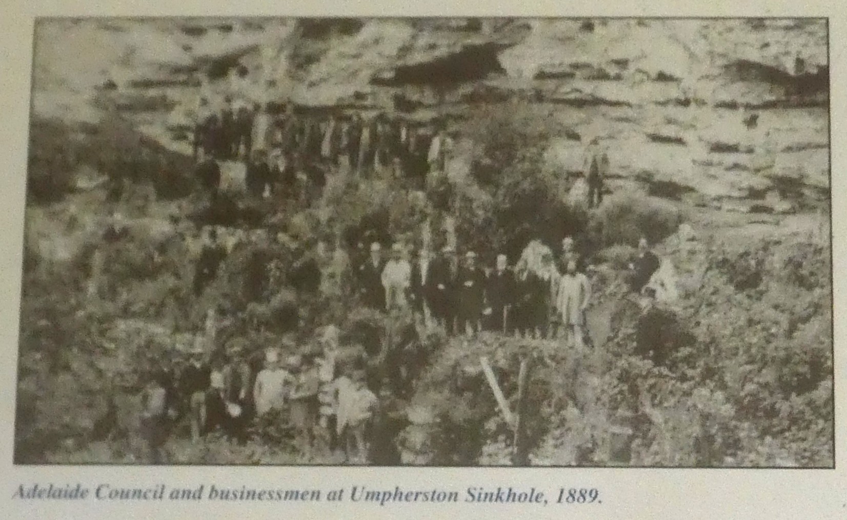
Eventually, the garden fell into disrepair. In the 1970s, the SA Woods and Forests Dept hired Ken Norton to oversee the redevelopment of the sinkhole, and with the work of many volunteers, he turned it into what we have today. And it’s stunning.
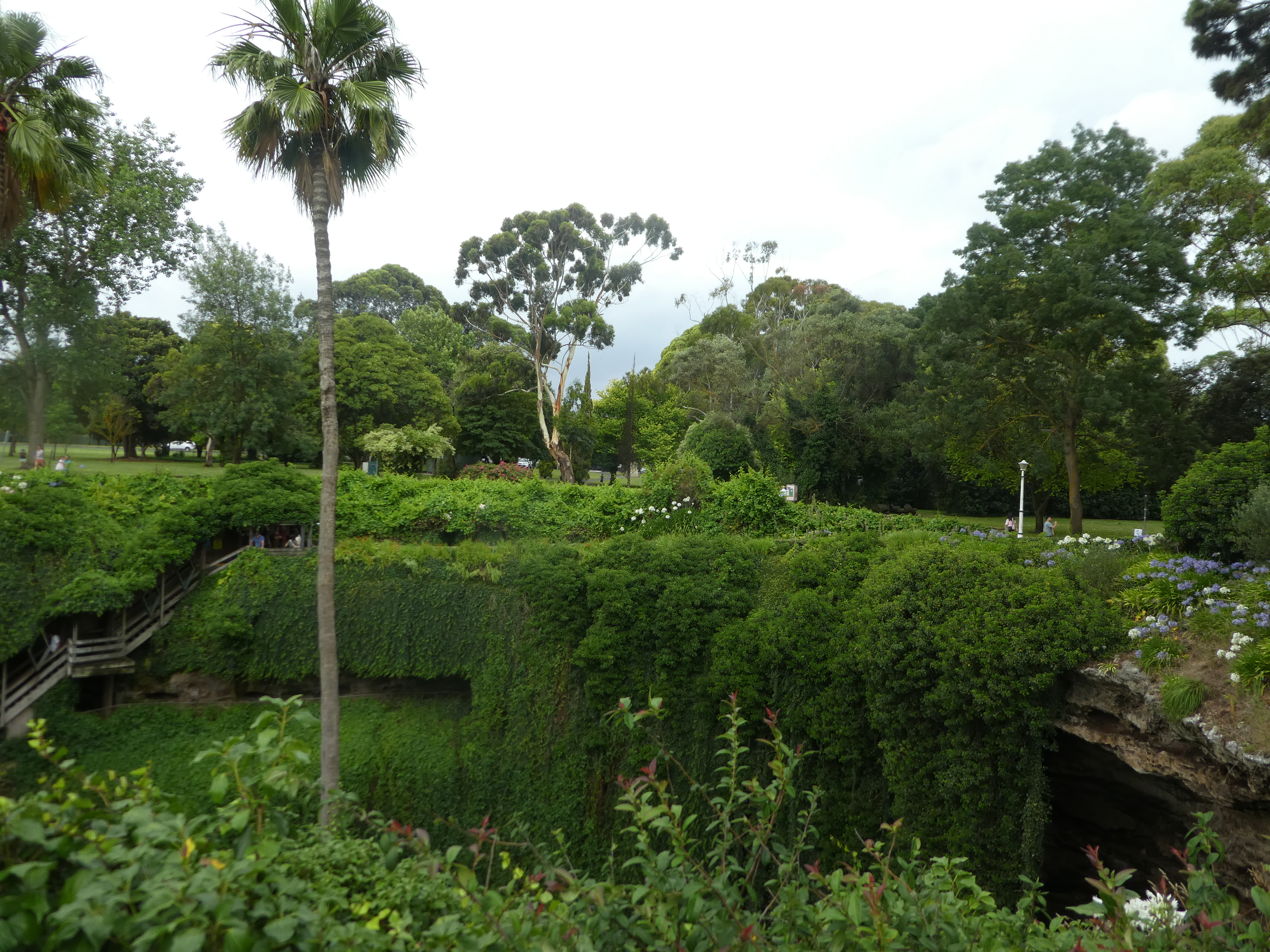

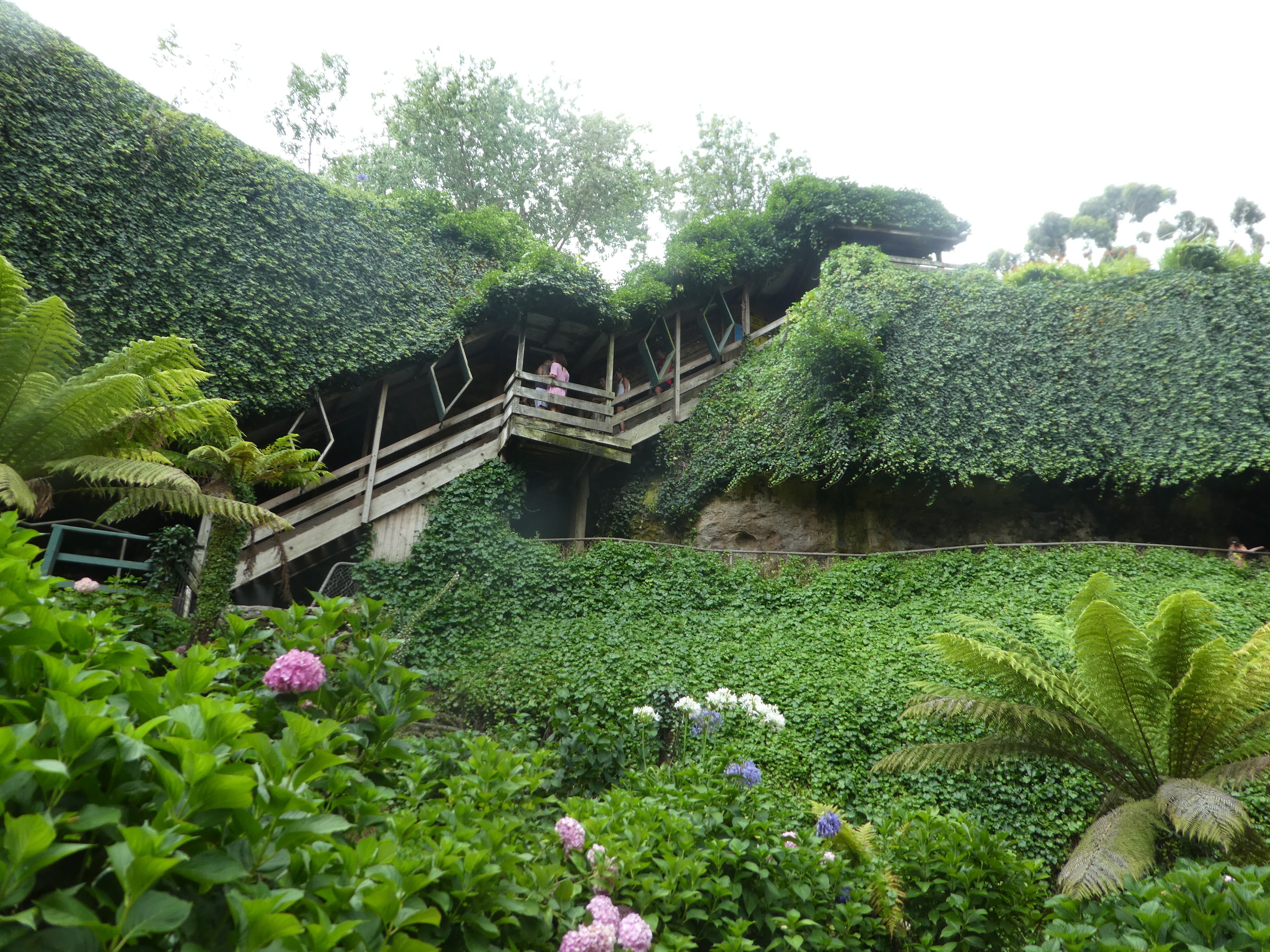


I sat on the seat on the floor of the sinkhole for awhile, and even though there were people coming and going it was extremely peaceful, and much cooler than up top.
The next morning I headed back home, promising myself a return trip. I love all that volcanic stuff and having visited Naracoorte Caves years ago, I’m keen for another look. I love caves. I have a terrible fear of heights but I can go into the bowels of the earth without the tiniest problem. Weird.
Talking about nature as I’ve been doing, on Friday I’m off to Tassie (Tasmania for my overseas readers), my first trip in 12 years, starting with my favourite spot, Arthur River, featured in my book, The Edge of the World: Next Stop Cape Horn. Can’t wait.

Mount Gambier is a really unique and beautiful area, and Umpherston sink hole is so pretty despite its name. 🙂 We need to spend more time down there too, the blue lake is incredibly blue at the right time of year. Can’t wait to read about Tassie, it’s somewhere still on our list to visit, hopefully in the next year or two.
LikeLike
Thanks so much, Glenys. I’m definitely coming back to the Limestone Coast.
LikeLiked by 1 person
Oh you’ve got me going now. I hadn’t heard of that sink hole. I love the one in the heart of town. Looks like I’d better pencil that one in.
LikeLike
Great, Lindsey. It’s a cut above the one in town, for sure.
LikeLiked by 1 person
Mount Gambier looks a very interesting place to visit.
LikeLiked by 1 person
That whole area is pretty interesting, Marion.
LikeLiked by 1 person
Thanks 👍
LikeLike
Thanks.
LikeLike
Thank you for the tour. You saw some excellent sites.
LikeLike
Thanks a lot for reading, Neil.
LikeLiked by 1 person
Fabulous!
LikeLiked by 1 person